Budget Travel Posts on Crowch
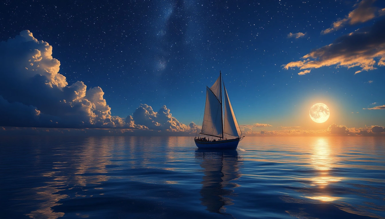
Traveling across Europe doesn’t have to be expensive. Thanks to low-cost airlines, you can fly between countries for less than the price of a restaurant meal. Tickets from €10–20 are real — if you know where, when, and how to book them.
Low-cost carriers reduce prices by removing extras. A standard ticket doesn’t include checked luggage, meals, or seat selection. Everything is optional and comes at an extra fee. But in return, you get access to extremely cheap fares, especially if you book early.
Some of the most popular budget airlines in Europe are Ryanair, Wizz Air, easyJet, Vueling, Transavia, Eurowings, and Norwegian. Each has its own focus: Ryanair flies widely across the continent including to smaller airports, Wizz Air targets Central and Eastern Europe, and easyJet focuses more on domestic routes in France, Germany, Italy, and the UK.
To save money, book 4–6 weeks in advance. The cheapest tickets often appear on weekdays, especially Tuesday and Wednesday. Use flight comparison tools like Skyscanner, Momondo, or Google Flights to find deals — but book directly on the airline’s website to avoid hidden fees and access exclusive offers.
Be aware that most low-cost carriers limit free cabin luggage. Usually, you’re only allowed a small bag (about 40×25×20 cm) that fits under the seat. Standard cabin bags or checked luggage must be paid for separately. Also, check the airport you’re flying from — Ryanair, for example, often uses secondary airports located far outside the city, which may add time and cost to your journey.

Extra fees can also apply to things like seat selection, priority boarding, an additional personal item, or even printing your boarding pass at the airport. Always read the fare rules before purchasing to avoid surprises.
That said, with a smart approach, low-cost airlines are a fantastic way to explore Europe. For example, a route like Berlin – Budapest – Milan – Barcelona – Paris can cost just €60–80 total if booked a month or two in advance. These prices make travel accessible even for students or those planning spontaneous weekend trips.
Flying with low-cost carriers is all about flexibility and attention to detail. Packing light, bringing your own snacks, and flying at less convenient hours can save a lot. But if you’re prepared for this, Europe becomes more affordable — and closer — than you ever expected.

Staying connected while traveling used to be expensive and inconvenient. Now, eSIM technology makes mobile connectivity abroad faster, easier, and often cheaper. But how does it actually work in foreign countries — and is it the right option for your next trip?
🔹 What is eSIM?
An eSIM (embedded SIM) is a digital version of a SIM card built into your smartphone, tablet, or smartwatch. Instead of inserting a physical SIM, you download a cellular plan directly to your device by scanning a QR code or using a mobile app. Most modern phones — like iPhones from XR and newer, Samsung Galaxy S20 and up, Google Pixel models, and others — support eSIM.
🔹 Why Use eSIM When Traveling?
✅ Instant Activation: You can purchase and activate an international or local data plan before your trip — no need to hunt for SIM cards at the airport.
✅ Lower Costs: Local eSIM plans are often far cheaper than international roaming from your home carrier. Many options offer unlimited data or generous packages starting from just a few dollars.
✅ Multiple Networks: With dual SIM capability, you can keep your regular number for calls and messages while using the eSIM for mobile data abroad.

✅ Easy Management: Apps like Airalo, Holafly, Ubigi, and Nomad let you browse, purchase, and install eSIM profiles for 190+ countries. No physical delivery, no paperwork — everything is digital.
✅ Better Privacy & Security: You avoid handing over your passport or personal data to kiosk sellers in unfamiliar locations.

🔸 Things to Consider:
- 🌐 Check Compatibility: Not all phones support eSIM, and not all carriers or countries offer eSIM plans. Make sure your device is unlocked and eSIM-ready.
- 🚫 Country Restrictions: In some countries (e.g., Turkey or Egypt), you may need to register your phone’s IMEI number or face limitations on data usage after a certain period.
- 📶 Coverage & Speed: Quality of connection may vary. In remote areas, an eSIM may not offer better speeds than local SIM cards.
- 🔄 One-Time Use: Some eSIMs cannot be reinstalled if deleted. Always save your QR code and login info in a secure place.
🧳 Best Practices for Travelers:
- Compare Plans Before You Fly: Check apps or websites for the best eSIM deals in your destination country.
- Install While on Wi-Fi: Always activate your eSIM in a place with stable internet (e.g., your hotel or home) before relying on it abroad.
- Use Dual SIM Smartly: Route data through the eSIM while keeping your regular number active for calls, WhatsApp, or 2FA messages.
- Read Reviews: Look at user experiences for specific eSIM providers. Some are great for speed; others focus on affordability.
Using an eSIM while traveling is one of the smartest tech upgrades you can make. It eliminates the hassle of buying a local SIM, avoids roaming charges, and gets you connected instantly — all from your phone.
If you travel frequently or just want a smoother arrival in a new country, eSIM is worth trying. The freedom to stay online wherever you go is just one scan away.
✈️📱💡
🌋 A Lake Like No Other
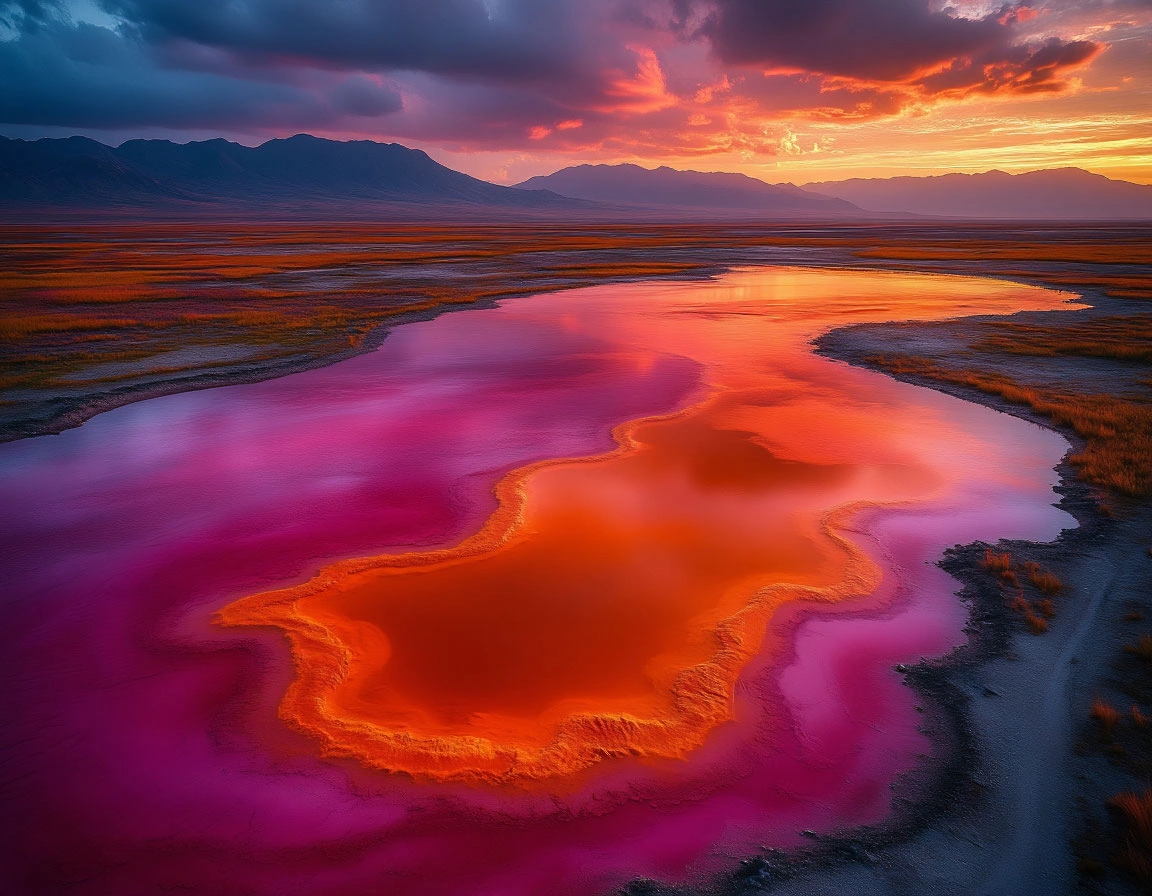
Tucked near the Tanzanian-Kenyan border, Lake Natron is one of the most hauntingly beautiful—and lethal—places on Earth. Seen from above, it resembles an alien canvas: swirls of crimson, rust-orange, and scarlet ripple across the land like spilled ink. But this stunning appearance conceals a deadly reality. Lake Natron is not just a salt lake—it’s a natural trap where water itself becomes a weapon.
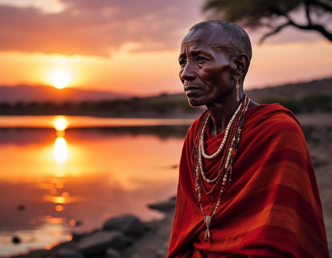
From its chemical composition to its blistering climate, everything about Natron defies the logic of survival. Masai tribes, who live in the region, speak of the lake with a mix of reverence and fear. For them, it is both sacred and forbidden—a place where the earthly and spiritual worlds overlap.
🧪 When Water Becomes a Caustic Tomb
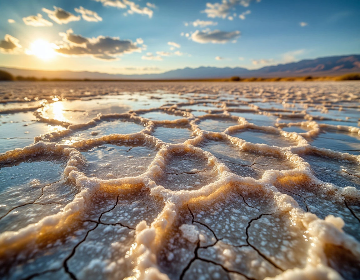
The danger of Natron lies in its extreme chemistry. The water’s alkalinity can soar to a pH of 12.5—more corrosive than household ammonia. Temperatures regularly exceed 50°C (122°F), turning the lake into a simmering basin. It contains high levels of sodium carbonate, or natron—a mineral used in ancient Egypt for embalming mummies. At Lake Natron, nature performs the mummification process unaided.
From the air, the lake’s reflective surface can resemble ice, tricking migratory birds into landing. But what looks solid is in fact caustic sludge. Once touched, the hot alkaline water quickly dehydrates and calcifies organic matter. Birds and bats become eerily preserved in their final moments, their bodies encased in a crust of salt and soda—frozen in time like statues.
🌫️ The Lake Where Even Rain Disappears
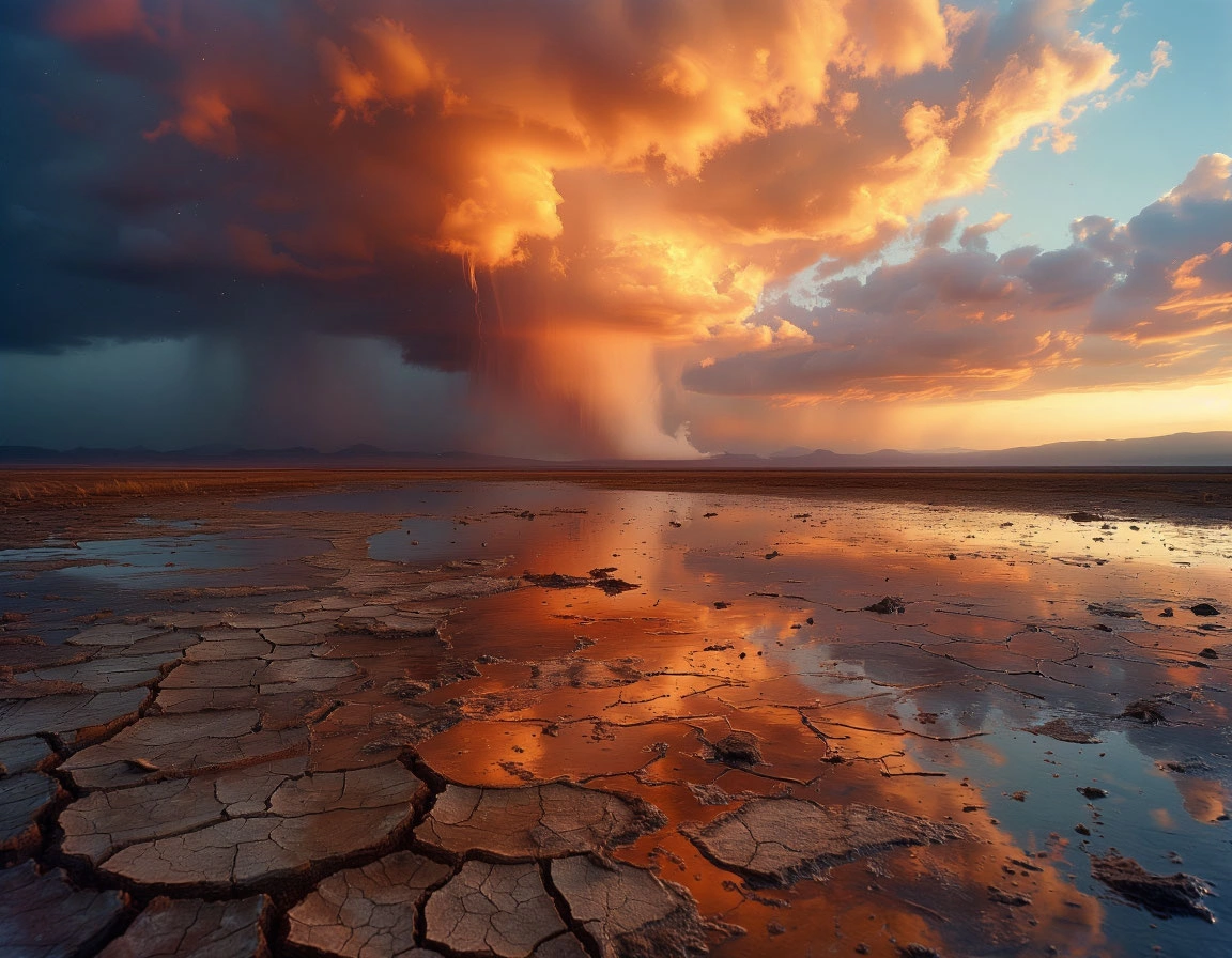
Surrounded by volcanic mountains and baked by the East African sun, Lake Natron is located in one of the driest regions of the continent. Even when rainclouds gather, the moisture often evaporates midair before touching ground. Locals refer to this eerie phenomenon as “phantom rain.” It’s a poetic name for a brutal paradox—where clouds weep, but the land remains untouched.
This climate contributes to Natron’s hostile nature. The high evaporation rate concentrates salts even further, making the lake more toxic with each passing season. No outlet means no escape for these minerals—they remain, building layer upon layer of chemical intensity.
🐟 Who Lives in the Alkaline Abyss?
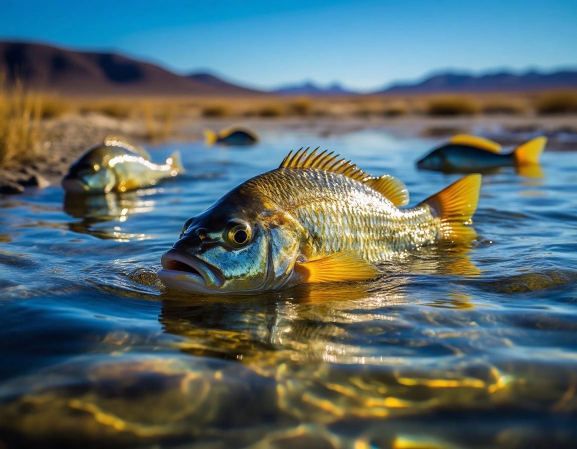
Despite the seeming lifelessness, Lake Natron is not entirely barren. Evolution has carved out niches for survival in even the most hostile ecosystems. Meet the alkaline tilapia—a resilient fish species that thrives in pockets of less saline water near the lake’s edges. These hardy swimmers can reproduce and breathe in conditions that would kill most life forms.
Beneath the surface, colonies of cyanobacteria flourish. These microorganisms not only survive but thrive in the alkaline waters, and in doing so, they dye the lake in dazzling hues—shades of red, orange, and pink. Their pigments protect them from the intense UV rays, giving the lake its iconic alien glow.
🦩 Flamingos in a Sea of Danger
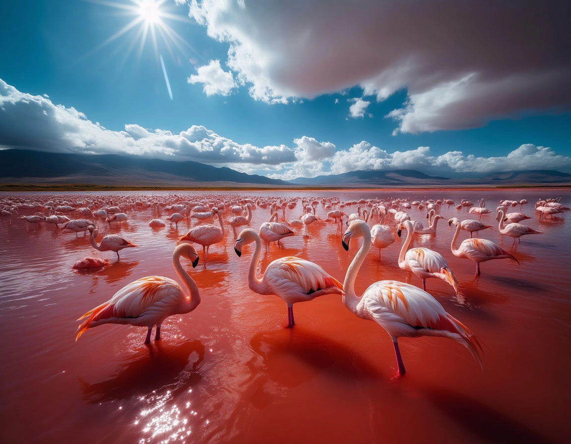
The most astonishing life at Lake Natron isn’t microscopic. It's feathered and pink. This inhospitable lake is home to the largest breeding colony of lesser flamingos in the world. Every year, up to two million flamingos gather on its salty shores, transforming the landscape into a sea of fluttering pink wings.
Why choose such a dangerous location? Precisely because of its danger. Flamingos nest on hardened salt ridges, isolated from predators who can’t withstand the lake’s harsh conditions. The birds avoid direct contact with the lake’s most caustic zones, using shallow pools and mud flats to build their nests. Here, surrounded by boiling waters and toxic mud, they find relative safety for raising their young.
🧭 More Than Science: A Portal of Myths and Power
To scientists, Lake Natron is a geochemical anomaly—a rare natural laboratory where few dare to study close-up. To the Masai, it’s a spiritual nexus. Stories passed down through generations speak of ancestors and spirits dwelling by the lake’s shores. Some believe it is a gateway to the afterlife, a place where the boundaries between the physical and the divine are blurred.
Standing near the lake, it’s easy to understand why myths flourish here. The eerie silence, shimmering air, and petrified remains scattered along the shoreline make it feel like a scene from ancient legend or science fiction. This is where nature transforms into something symbolic—violent yet sacred, terrifying yet beautiful.
🧳 Final Reflection: When Nature Says “Keep Out”
Lake Natron is not a trick of Photoshop or a surrealist art piece. It’s very real—and very dangerous. Here, water doesn’t cleanse; it scalds and fossilizes. Here, birds don’t merely die; they become monuments. And yet, amid this elemental fury, life persists. Adapted creatures find sanctuary in the unlikeliest of places, protected by the very forces that destroy others.
If you ever travel to northern Tanzania, approach Natron with respect—and from a safe distance. This lake is a living reminder that nature’s power is not always welcoming. Not because it’s evil, but because it is untamed. In that wildness lies its awe. Its authority. Its warning.
🇮🇷 Iran: Land of the Aryans

Despite frequent confusion with Iraq, Iran is a world apart — culturally, linguistically, and historically. Unlike its Arab neighbors, Iran is not an Arab nation. The majority of its population are Persians who speak Farsi, a language belonging to the Indo-European family. This linguistic distinction alone points to ancient origins.
The name Iran derives from the word Aryana, which translates to "land of the Aryans." The Aryans were ancient Indo-European tribes believed to have migrated south from the steppes of Central Asia, including areas that are now Kazakhstan and southern Russia. These tribes later laid the foundations for the great civilizations of Persia and India.
Until 1935, the country was known internationally as Persia — a name derived from the region of Pars (modern-day Fars), the cradle of the Achaemenid Empire. But that year, Reza Shah Pahlavi requested the international community to use the local name "Iran" to emphasize the nation’s deep historical roots and unity.
Today, the name Iran continues to reflect its mythological and historical identity — a reminder of Zoroastrianism, epic poetry like Ferdowsi’s Shahnameh, and a civilization at the heart of the crossroads between East and West.
🇮🇶 Iraq: Shoreline of Civilizations
Iraq — though often geopolitically entangled with Iran — carries a legacy of its own, dating back to the dawn of civilization. This is the land of Mesopotamia, the "land between rivers," where the Sumerians, Akkadians, Babylonians, and Assyrians changed the world by inventing the wheel, writing, and city-states.
The Arabic word al-‘Irāq likely stems from a term meaning "shore" or "lowlands," referring to the fertile riverbanks contrasting the surrounding deserts. During the early Islamic era, the name encompassed a larger region that included both Arab and Persian lands.
Baghdad, the capital, rose to intellectual prominence under the Abbasid Caliphate, drawing scholars from across the Islamic world. Thinkers like Al-Khwarizmi and Avicenna studied here, turning Iraq into a hub of science, philosophy, and medicine.
Thus, Iraq is more than a name. It's a riverbank soaked in the history of humanity — a place where myth, empire, and knowledge met in a unique and lasting legacy.
🇪🇬 Egypt: Land of the Black Soil and Soul of Ptah
Modern minds associate Egypt with pyramids, pharaohs, and the Sphinx. But the name "Egypt" masks deeper cultural layers. The ancient Egyptians called their land Ta-Kemet, or "Black Land," referencing the dark, nutrient-rich soil deposited by the Nile’s annual floods — a stark contrast to the surrounding Ta-Deshret or "Red Land" desert.
Later, in Coptic Christian tradition, the name Kemet persisted. But after the Arab conquest in the 7th century, a new name took root: Misr. In Arabic, it denotes not only a nation but a well-settled, civilized area — a place of order amidst nomadic chaos. Misr also carries significant meaning in Islamic texts, often symbolizing civilization itself.
Meanwhile, the Western name Egypt stems from the ancient Greek Aigyptos, a distorted version of the ancient phrase Hut-Ka-Ptah — “Home of the Soul of Ptah.” Originally, this referred specifically to Memphis, one of the oldest and most sacred cities of ancient Egypt.
Today, Egypt stands as a country with three coexisting names — Ta-Kemet, Misr, and Egypt — each telling a different chapter of a 5,000-year-old story.
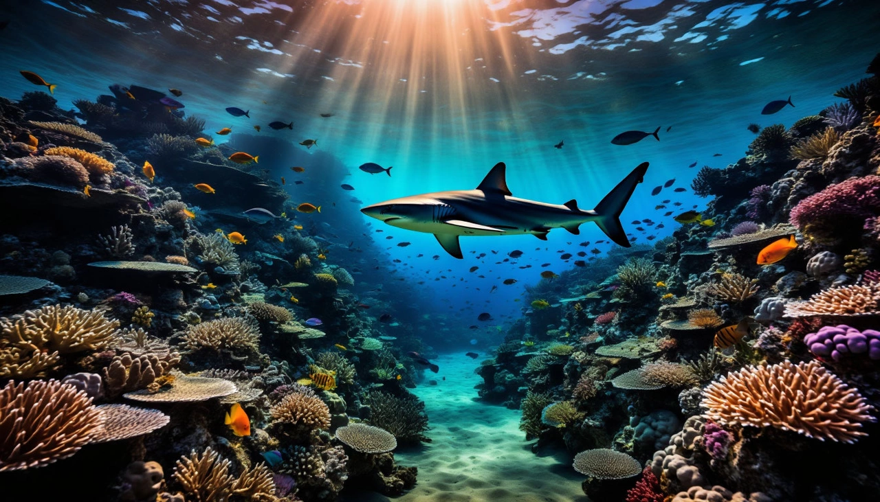
🌊 The Red Sea, Egypt: A Hidden Predator’s Playground
The Red Sea, renowned for its warm waters and vibrant coral reefs, is a magnet for tourists from Europe and beyond. Its underwater canyons and colorful marine life offer unforgettable experiences. Yet beneath this idyllic facade lurk some of the ocean’s most formidable shark species.
Among the sharks encountered off Egypt’s coast are the longfin mako, whitefin, tiger, and mako sharks. The longfin mako is especially notorious, hunting in open waters but often venturing near crowded shores. Whitefin sharks, once deep dwellers, now frequent shallower waters, drawn by changing environmental conditions. These sharks are swift and aggressive, capable of sudden attacks triggered by rapid movements or glints from jewelry.
Tiger sharks are less predictable, earning the nickname "the ocean’s garbage collectors" because they eat almost anything — from turtles to debris. They often approach shorelines where fish waste enters the water, striking without hesitation.
Despite tens of millions of tourists visiting the Egyptian coast in the past decade, reported shark attacks remain rare. However, when attacks do occur, they tend to be severe or fatal due to the sharks’ speed and unpredictability, capable of bypassing safety measures and appearing where swimmers feel safest.
🇹🇷🇬🇷 Mediterranean & Aegean Seas: Tourist Havens with Caution
Turkey’s and Greece’s Mediterranean and Aegean coasts are beloved for their warm seas, picturesque landscapes, and lively resorts. These waters teem with marine life, including sharks that occasionally pose risks to humans.
Bull sharks, sand sharks, and hammerheads inhabit the depths near popular resorts such as Antalya, Alanya, Bodrum, and Marmaris. Hammerhead sharks are often sighted not far from shore, typically avoiding swimmers but drawn closer by shifting water temperatures and altered migratory paths.
Sharks here tend to avoid humans, but ecological changes like increased boat traffic, illegal fishing, and environmental stress push them into new territories, raising chances of accidental encounters. Seasonal factors play a role: in summer, sharks retreat deeper to cooler waters, while in off-seasons, they sometimes approach shallows chasing fish schools.
Though attacks are extremely rare, the sharks’ keen senses and sudden reactions mean that swimmers should remain vigilant, even in well-maintained tourist spots.
🏝 Caribbean Sea: Paradise with Predators
The Caribbean conjures images of soft white beaches and turquoise waves, attracting millions of vacationers annually. Yet beneath this tropical beauty, predators like bull, lemon, tiger, and great white sharks thrive.
Islands such as the Bahamas, Dominican Republic, Jamaica, Cuba, and the Cayman Islands are shark habitats. Bull sharks are common in shallow bays, especially near river mouths, showing little fear of humans and adapting easily to coastal areas. Tourists feeding fish or discarding food waste can unknowingly attract them close.
Lemon sharks, more secretive and nocturnal, inhabit specific territories but can become aggressive if provoked. Tiger sharks frequent deeper waters but move shoreward near fishing zones, while great whites generally stay farther out but occasionally appear near resorts, influenced by changing climate and fish migrations.
🌏 South China Sea: Thailand & Vietnam’s Aquatic Edge
The tranquil waters of Thailand and Vietnam offer tropical charm and diving adventures, yet the South China Sea remains a wild frontier. Sharks such as mako, tiger, white, and gray reef sharks populate deep waters but sometimes venture closer to shore.
Regions like Phuket, Krabi, Ko Tao, and Da Nang have reported rare shark encounters, often near rocky outcrops or coral reefs frequented by divers and fishermen. Environmental factors like water temperature fluctuations and increased human activity disrupt shark behavior, increasing risks.
Tourism’s vital economic role leads to limited public disclosure of incidents, so actual shark interactions may be underreported. Visibility can be severely reduced during the rainy season, heightening chances of accidental attacks when sharks mistake humans for prey.
🌴 Gulf of Mexico: A Diverse Ecosystem with Hidden Risks
The Gulf of Mexico is a bustling marine environment rich with biodiversity. Its warm, shallow lagoons and reefs provide perfect conditions not only for tourists but also for large shark species like white, bull, and tiger sharks.
These sharks are powerful, fast, and adapt well to busy coastal zones where swimmers, surfers, and boaters coexist. Factors like splash noise, food scraps, and heavy marine traffic may confuse sharks, triggering defensive or aggressive behavior.
Surfers and divers face particular risks, especially if they venture far from shore or swim in murky waters where sharks hunt. Though attacks remain infrequent, they tend to rise during warmer months when shark activity peaks.

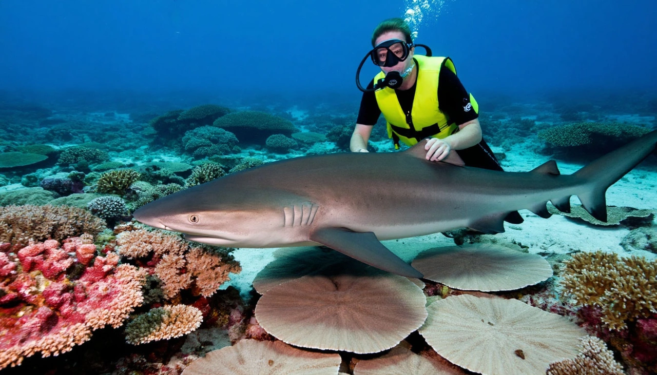
🛡️ Stay Safe, Stay Smart: Navigating Nature’s Realm
Panicking over every splash is unnecessary. On guarded hotel beaches, obeying safety zones, and avoiding risky behaviors drastically reduce the already low chances of shark encounters. However, stepping outside these boundaries — swimming at dusk, diving unprepared, feeding fish, or entering murky water — shifts you from a visitor to a potential target in a natural predator-prey scenario.
Sharks don’t attack out of malice; they respond to instinctual cues. Awareness and respect for the marine environment are your best defenses. With mindfulness, you can enjoy nature’s wonders safely and avoid becoming part of the ocean’s food chain. The next time you gaze into the sea’s dark expanse, remember: a little caution can protect your life and your holiday.
The world's oceans cover over 70% of Earth's surface, yet much of their vast depths remain unexplored. Beneath the waves lie not only breathtaking landscapes and exotic marine life but also truly haunting and treacherous areas. Some oceanic regions have become symbols of human fragility—geographical anomalies where technology fails, civilization is powerless, and survival hangs by a thread. Let’s dive into three of the most fascinating yet dangerous oceanic zones: Point Nemo, the Blue Hole, and the Sargasso Sea.
🛸 Point Nemo: The Ultimate Isolation in the Pacific
Point Nemo, located in the South Pacific Ocean, is known as the "Oceanic Pole of Inaccessibility." This spot is the farthest from any land on Earth—approximately 2,700 kilometers away from the nearest shores, which lie in Chile and New Zealand. What’s even more surreal is that the closest humans are often astronauts aboard the International Space Station passing overhead.
Named after Captain Nemo from Jules Verne's novels, this place perfectly embodies isolation. Radio signals rarely reach it, commercial shipping routes avoid it by hundreds of kilometers, and it is so remote that even the most daring sailors hesitate to traverse this area.
Despite its isolation, some have crossed this region. Renowned Russian adventurer Fyodor Konyukhov famously rowed through Point Nemo alone, describing it as one of the most emotionally intense experiences of his life—a crushing sense of cosmic solitude.
Point Nemo also serves as a “spacecraft cemetery.” Since the 1970s, space agencies have directed decommissioned satellites and space stations to crash here, including the Russian Mir station, minimizing risk to humans and infrastructure.
But the danger lies not just in space debris, but in the utter remoteness. Any accident or technical failure here is life-threatening. Rescue can take weeks, and assistance is virtually impossible. Point Nemo leaves anyone stranded entirely to their own devices—survival depends on luck and preparedness.
💙 The Blue Hole in the Red Sea: Deceptive Beauty and Deadly Depths
Near the Egyptian resort town of Dahab lies one of the ocean’s most notorious dive sites—the Blue Hole in the Red Sea. Seen from above, it appears as a perfect, deep blue circle encircled by coral reefs. This underwater sinkhole plunges about 130 meters deep and connects to the open sea through a narrow arch around 55 meters below the surface.
To divers worldwide, it’s a mesmerizing spot—but also a deadly trap.
At first glance, the Blue Hole seems inviting: calm waters, clear visibility, and gentle currents. But beneath this tranquil exterior lurks a unique hazard—nitrogen narcosis. When diving deeper than 30 meters, the increased pressure causes nitrogen in the air to affect the brain like a narcotic. Divers can experience euphoria, confusion, and impaired judgment—deadly when oxygen supplies are limited.
The arch at 55 meters is especially dangerous. Many inexperienced divers attempt to swim through it, underestimating the risks of pressure, oxygen consumption, and time limits. The result is often disorientation, panic, and sometimes fatal accidents. Over 180 divers have lost their lives here in the past 20 years, commemorated by a memorial on the shore.
The Blue Hole’s allure is undeniable, but only experienced and well-prepared divers should attempt to explore its depths. It’s a stark reminder that underwater beauty can hide lethal risks.
🌿 The Sargasso Sea: Endless and Enigmatic
In the Atlantic Ocean lies a sea with no land boundaries—the Sargasso Sea. Bounded only by four major ocean currents forming a rotating gyre, it sits between the Azores, Bermuda, and the Caribbean. The sea is famous for its clear blue waters and a vast floating carpet of brown seaweed called Sargassum.
Historically, this sea has been the site of numerous “ghost ship” legends. The thick mats of seaweed entangle ship hulls, and the weak winds inside the gyre made sailing nearly impossible for old sailing vessels, leaving crews stranded in an eerie, motionless expanse.
This unique ecosystem supports a wide variety of marine life adapted to the floating seaweed habitat. But for sailors, it was often a watery trap. Even modern boats can lose maneuverability in dense Sargassum patches. The sea seems almost alive in its resistance to movement.
Within the Sargasso Sea lies the infamous Bermuda Triangle, surrounded by myths of disappearing ships and planes. While many of these stories have logical explanations—volatile weather, strong whirlpools, and heavy traffic—the region’s mystique endures.
The Sargasso Sea feels otherworldly—silent, vast, and unnervingly still. Every engine hum or splash sounds out of place, amplifying a deep sense of isolation and mystery.
🌐 Oceanic Wonders and Warnings
Point Nemo, the Blue Hole, and the Sargasso Sea each represent vastly different oceanic phenomena. One is the epitome of isolation, another a deceptively beautiful but deadly dive spot, and the third a vast, shifting sea woven with mystery and danger.
What unites them is the reminder that the ocean is not our domain. Here, familiar landmarks vanish, help is distant or nonexistent, and the rules of the civilized world often fail. Despite our technological advancements—from space exploration to AI—we remain vulnerable in the very environment that nurtured human life.
Perhaps this blend of awe and fear is what makes the ocean so irresistibly fascinating—and why these extraordinary zones continue to capture our imagination.
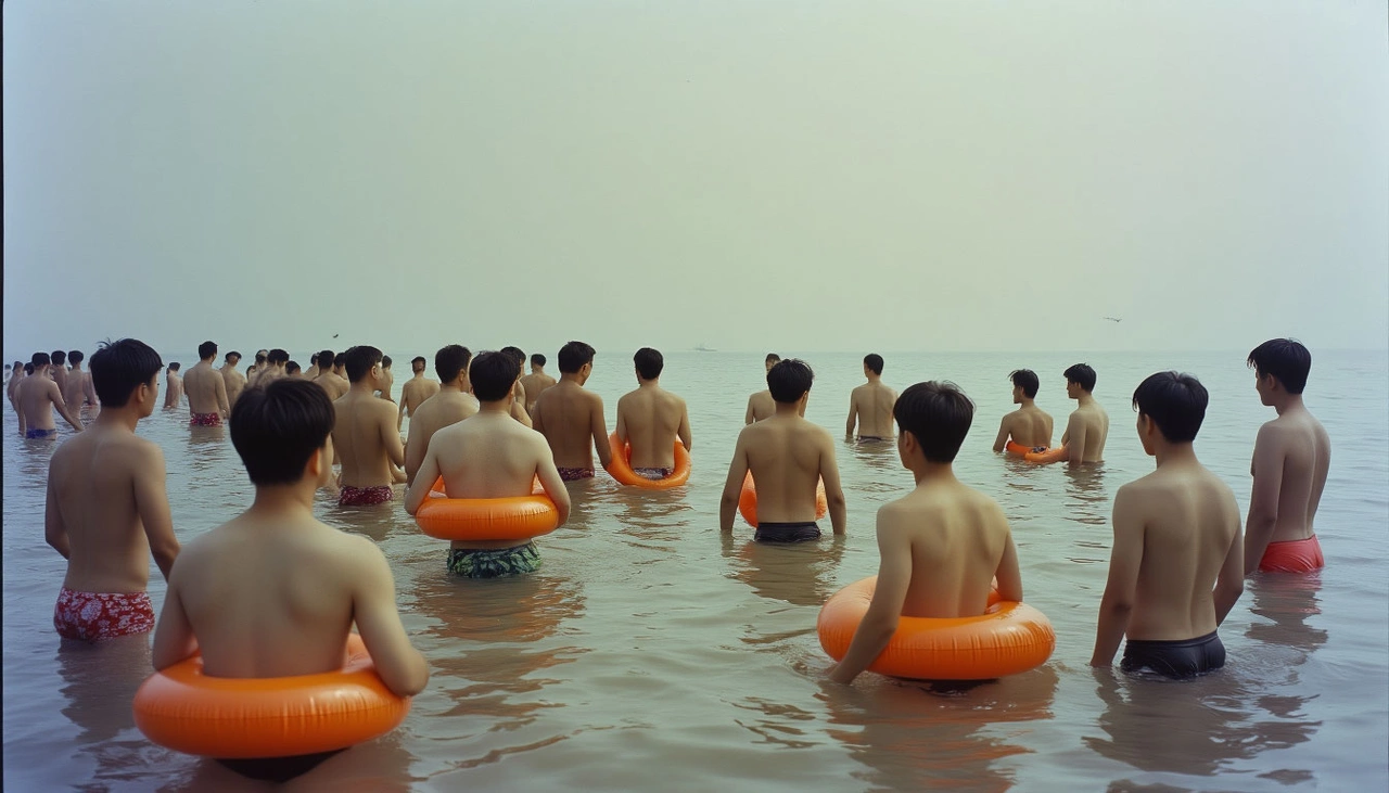
Swimming Is Not an Innate Skill — It’s Learned and Culturally Shaped 🏊♂️
Swimming, contrary to popular belief, is not a natural ability inherent to all humans. It’s a learned skill that depends heavily on opportunity, environment, and cultural motivation. Historically, swimming was primarily necessary for specific professions—fishermen, sailors, and soldiers. For most people, especially before the 20th century, swimming was rare and often non-essential.
In Western countries, the culture of recreational swimming developed alongside growing wealth, paid holidays, and the rise of beach tourism, starting in the early 20th century. In contrast, East Asian countries like China, Japan, and Korea embraced this cultural shift much later or only partially.
Rice Farming Societies: Labor Intensity Leaves Little Room for Leisure 🌾
The economies and societies of China, Korea, and Japan have been deeply influenced by rice agriculture. Unlike wheat, rice cultivation demands meticulous, labor-intensive care involving careful water management and strict timing. Any delay or mistake can result in crop failure. Consequently, work rhythms in these societies have historically been relentless, with minimal breaks and few days off.
Even today, in urban environments, working hours are long, overtime is the norm, and vacation time is often sacrificed for career advancement. Leisure activities like swimming, which require time, relaxation, and a break from routine, often don’t fit into this demanding lifestyle.

Leisure Time Was a Luxury for Generations ⏳
Japan’s economic boom only really took off after World War II, gaining momentum in the 1970s. Korea’s rise began mostly in the 1990s, while China’s rapid urbanization and income growth started around the early 2000s. This means mass access to leisure, including swimming, arrived very recently—within a generation or two.
Meanwhile, Western societies have enjoyed widespread access to pools and beaches for nearly a century, embedding swimming deeply into their culture. In many East Asian families, swimming is not viewed as a necessary or expected skill, and many parents don’t prioritize teaching their children.
Geography and Climate: Not Always Swimming-Friendly 🏔️🌧️
Despite the long coastlines, the natural environment of East Asia doesn’t always invite swimming. Japan and South Korea are mountainous countries with short, cold, fast rivers—far from the calm, warm waters ideal for swimming lessons. These rivers are noisy, shallow, and unpredictable, discouraging recreational use.
The seas bordering these countries, especially the Pacific coast, are often turbulent. Strong tides, currents, and sudden weather changes are common, along with frequent typhoons and storms, creating real dangers at the beach.
China’s terrain is more varied, but many rivers are muddy, prone to flooding, or surrounded by agricultural land, making easy and safe access to open water scarce. Moreover, winters in these countries are cold and long, shortening the swimming season to just a few months a year, further limiting regular practice.

Cultural Norms: Modesty, Shame, and Fear of Embarrassment 🙈
Cultural factors also play a crucial role. In many East Asian societies, social conformity and modesty are highly valued. The fear of standing out or being judged negatively often discourages people from trying activities where failure or awkwardness is visible.
Swimming involves exposure of the body and unfamiliar movements, which can trigger discomfort and embarrassment, especially for women. In Japan, for instance, many young women prefer to swim fully clothed or cover up extensively at the beach, which complicates swimming instruction and participation.

Current Reality: Basic Swimming Skills but Limited Confidence in Open Water 🌅
There is no precise data on swimming proficiency in these countries, but trends are clear. In Japan, nearly all children learn to swim in school pools, which are often shallow and designed more for water safety and comfort than mastering advanced swimming. Many adults can swim but prefer to stay close to the shore or avoid deep waters.
China’s situation varies by region. Urban children increasingly take swimming lessons at schools or private pools, but rural populations often lack access to facilities or safe natural water bodies, leaving many without swimming skills.
South Korea shows a similar pattern: swimming education exists, but it focuses on basic survival skills. Even confident swimmers tend to approach the ocean cautiously, frequently using life jackets or flotation devices.

Conclusion: A Complex Mix of History, Environment, and Culture 🎎🌏
The rarity of confident swimming among Japanese, Chinese, and Korean people isn’t due to an inherent inability but rather a combination of historical labor demands, environmental challenges, cultural values, and limited leisure time. The sea has traditionally been seen as a powerful, dangerous force rather than a place for recreation.
While urbanization and modernization have improved access to swimming lessons and pools, especially for younger generations, the cautious attitude toward open water remains strong. Even those who can swim often prefer to stay near the shore, driven not just by fear but by deeply ingrained habits and cultural norms.
For many of us, school geography lessons taught a simple fact: there are four oceans on Earth — the Arctic, Atlantic, Indian, and Pacific. However, on some maps, a fifth ocean appears — the Southern Ocean. This discrepancy has sparked ongoing debates reminiscent of whether Pluto should be considered a planet or not. So, what’s the truth? Is the Southern Ocean truly a separate and full-fledged ocean? Let’s dive into the history, geography, and politics behind this watery enigma and clarify how many oceans really cover our planet.
🌍 Historical Background: The Origin of the Ocean Count
The concept of an ocean as a distinct geographic entity goes back centuries. The first known classification separating a southern ocean was made by Dutch geographer Bernhard Varenius in 1650. However, this was more theoretical, as much of the southern waters surrounding Antarctica were unexplored and poorly understood at the time.
Back then, explorers noticed unique characteristics in these southern seas: stronger winds, icy waters, and the presence of glaciers — features that set these waters apart from other oceanic regions. Even today, the Southern Ocean is defined by the confluence of cold Antarctic currents with warmer waters from the Atlantic, Pacific, and Indian Oceans. This natural boundary shifts seasonally, which complicates drawing fixed borders.
🗺️ The Modern Debate and Official Recognition
Interest in the Southern Ocean’s official status reemerged strongly in the 20th century. It began in 1920 during discussions within the International Hydrographic Organization (IHO), which includes about 100 member countries. After long debates, the IHO decided to acknowledge the Southern Ocean and established provisional boundaries.
However, these boundaries were subject to frequent revision based on scientific discoveries and geopolitical considerations. Only at the dawn of the 21st century — in the year 2000 — did the IHO formally declare the division of the world’s waters into five oceans, including the Southern Ocean as a distinct entity.

❄️ The Southern Ocean in Facts and Figures
The Southern Ocean surrounds Antarctica, stretching roughly from the continent’s coast northwards to about the 60th parallel south latitude. It covers approximately 20.3 million square kilometers, making it the fourth largest ocean by area, after the Pacific, Atlantic, and Indian Oceans.
Its deepest point lies in the South Sandwich Trench, plunging down to about 8,264 meters. This ocean is home to unique wildlife such as emperor penguins, elephant seals, orcas, and Antarctic krill — a tiny crustacean that forms the foundation of the marine food web, feeding numerous fish, birds, and mammals.
One remarkable natural phenomenon here is the Antarctic Convergence, where cold Antarctic waters meet warmer waters from the north, creating nutrient-rich zones that support abundant marine life. Additionally, the Southern Ocean plays a crucial role in regulating global climate by circulating water masses that transfer heat and carbon dioxide between the poles and the equator.
⚖️ Why the Controversy Continues
In 2023, the IHO revisited the issue and formally approved a resolution confirming the Southern Ocean’s status and boundaries, recognizing its unique characteristics and significance.
However, this hasn’t ended all disputes. The IHO’s decisions require ratification by member states to become universally accepted, and not all countries have agreed. Some nations, including Russia, have ambiguous or inconsistent representations of the Southern Ocean on their maps — sometimes recognizing it, sometimes not.
This patchwork of perspectives means that globally, the Southern Ocean remains something of a cartographic Schrödinger’s cat — simultaneously acknowledged and denied, depending on where you look. The debate has lost much of its intensity in recent years but persists quietly, reflecting broader themes of national interests, scientific interpretation, and geopolitical nuances.

🌐 Conclusion: A Fluid Boundary in a Fluid World
The question “How many oceans are there on Earth?” does not have a simple, universally accepted answer. While five oceans are officially recognized by key scientific bodies, geopolitical realities mean that four remain the number many people know from schoolbooks.
Ultimately, the Southern Ocean represents more than just a body of water — it is a symbol of the dynamic and evolving nature of scientific knowledge, the intersection of geography and politics, and the complex way humanity relates to the natural world.
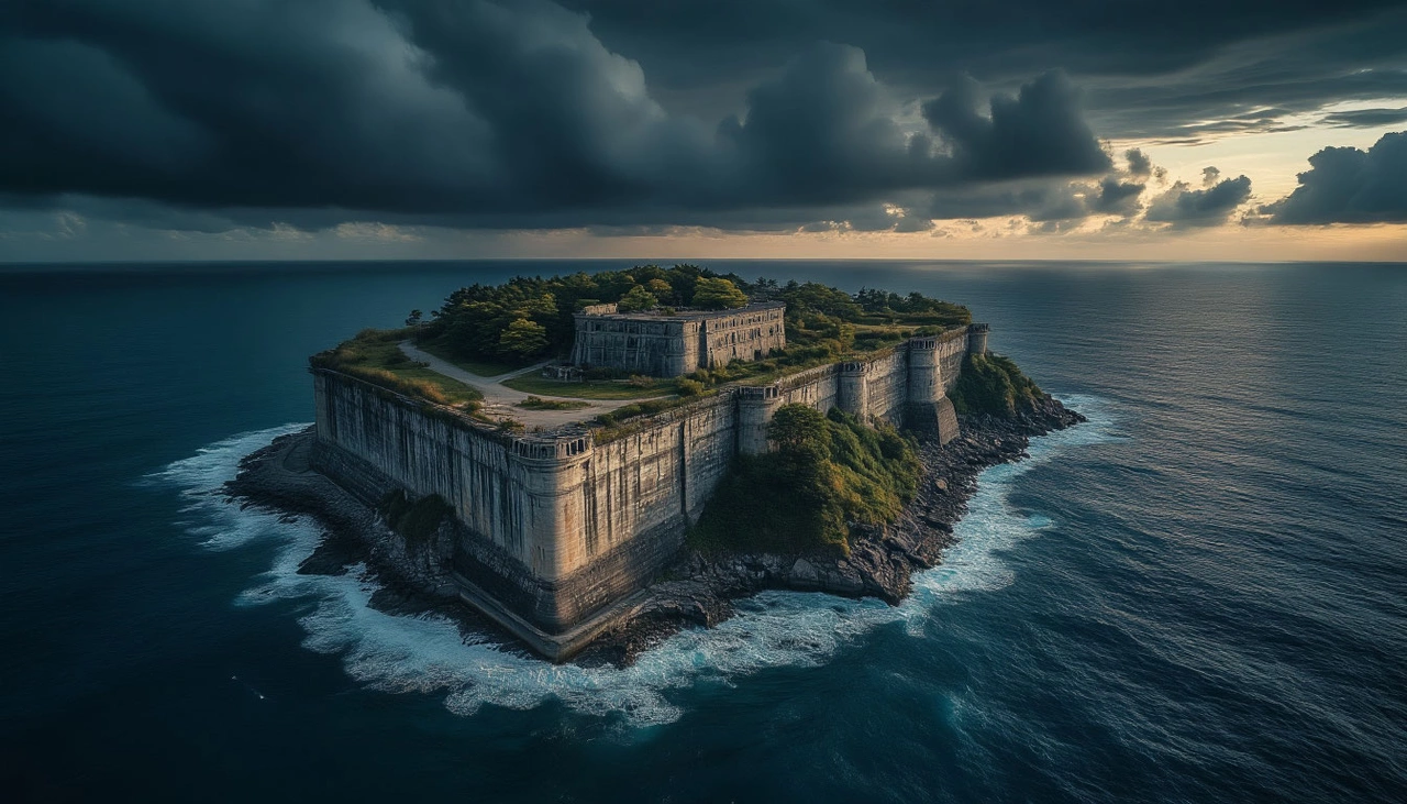
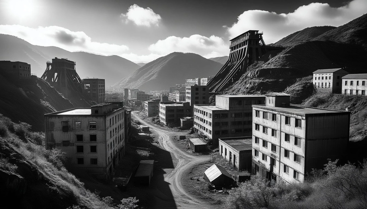
Nestled in the East China Sea just nine miles from the heart of Nagasaki, Japan, lies a small island with a story as compelling as it is tragic — Hashima Island, also known as Gunkanjima or “Battleship Island.” Its silhouette, resembling a massive warship encased in concrete walls, stands frozen in time, a ghostly remnant of an era long past. Today, Hashima is a deserted island, but only fifty years ago, it was one of the most densely inhabited places on Earth, bustling with life, industry, and hope.
⛏️ The Discovery That Changed Everything
Hashima’s story begins in 1810 when local fishermen stumbled upon rich coal deposits beneath its surface. Before that, the tiny island, spanning just 6.3 hectares (about 15.5 acres), was completely uninhabited and overlooked. This discovery would transform Hashima forever.
By 1887, the Fukahori clan had sunk the first coal mine shaft, and three years later, in 1890, the Mitsubishi Corporation purchased the island, rapidly industrializing it into a major coal mining center. The 20th century saw extensive construction: around thirty residential buildings, temples, schools, hospitals, over twenty shops, restaurants, and even swimming pools rose from the rocky island. Beneath the surface, deep coal shafts plunged 600 meters below the sea, fueling Japan's industrial revolution.
🏙️ The Pinnacle of Urban Density
By 1959, Hashima had reached the peak of its development. It became famous for having the highest population density in the world — an astonishing 139,100 people per square kilometer. Imagine an entire city crammed into less than seven hectares of land, where families lived in close quarters, children attended schools, and workers toiled day and night in the mines. Life on Hashima was intense, vibrant, and close-knit. Residents enjoyed amenities typical of larger cities: movie theaters, clubs, grocery stores, and social spaces where community life thrived. The island was a self-contained world of progress and modern living amid the relentless hustle of coal mining.

⚠️ The Dark Shadows Behind the Progress
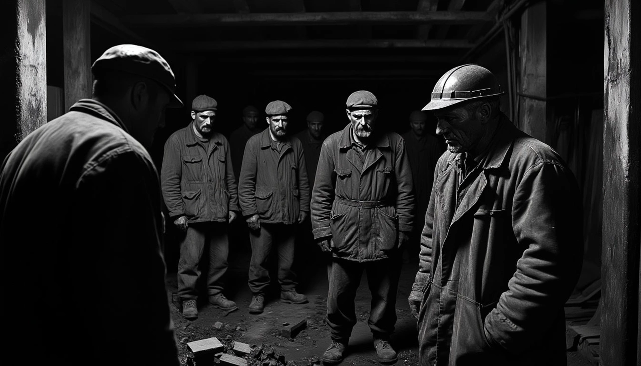
However, beneath this thriving facade lay a grim reality. Between 1943 and 1945, during World War II, Mitsubishi used forced labor, bringing in hundreds of Chinese and Korean prisoners of war to work under brutal conditions. These laborers endured inhumane treatment, starvation, disease, and deadly working environments. Many lost their lives in the deep mines or harsh living quarters.
This tragic chapter remains a painful memory, especially for South Korea, which continues to seek justice and compensation for the survivors. The scars of these events turned Hashima into a symbol not only of Japan's industrial might but also of human suffering and exploitation.
🛢️ Decline and Desertion
By the late 1960s, coal lost its economic importance, overtaken by cheaper petroleum fuels. Mines across Japan began closing, and Hashima was no exception. In early 1974, Mitsubishi announced the shutdown of mining operations. By March, the local school closed, and in April, the last residents departed, leaving behind an eerie ghost town.
Homes, shops, and schools were abandoned, with personal belongings left scattered like memories frozen in time. In just a few weeks, the once-bustling island fell silent, swallowed by decay.

🏚️ Decay and Rediscovery
After the evacuation, Hashima was left to the elements. Concrete buildings, once symbols of progress and modernity, began crumbling under the relentless assault of wind, rain, and sea spray. Japan’s government restricted access to protect the island from vandalism, but nature’s reclaiming was unstoppable.
Only in 2009 were limited tours permitted, opening a small, secure area for visitors. This change marked the beginning of Hashima’s transformation into a historical site, a monument to Japan’s industrial past. In 2015, Hashima was added to the UNESCO World Heritage list, recognizing its significance as a relic of industrial history despite protests from South Korea regarding its painful legacy. Today, boats ferry tourists from Nagasaki daily, eager to witness the haunting ruins and imagine life on this “island of ghosts.”
🌿 The Fragility of Human Endeavor
Hashima Island’s story resonates far beyond its concrete ruins. It is a stark reminder of how human ambition can rise to incredible heights — and how quickly nature can reclaim what we abandon. The island draws photographers, historians, and urban explorers fascinated by its eerie beauty and powerful story.
In 2013, Google captured panoramic images of Hashima, making it accessible to anyone worldwide via virtual tours. This digital resurrection preserves the island’s haunting spirit, allowing future generations to reflect on both the triumphs and tragedies of industrial progress.
Final Thoughts
Hashima is more than a ghost town. It is a symbol of human resilience, industrial innovation, and the harsh realities of history. Its desolation speaks volumes about the costs of progress and the importance of remembering every chapter — even the painful ones. As we explore its ruins, we are reminded that every place has a story, and some stories demand to be heard.

When ancient Greek thinkers compiled a list of the most breathtaking creations of human hands, they didn't set out to launch the world’s first "Top 7." Yet that's exactly what they did — not about music or tech, but about marvels that sparked reverence and astonishment. The "Seven Wonders of the Ancient World" became a tribute to ambition, divinity, imperial power, and aesthetic brilliance. But of those seven, time spared only one. The rest were claimed by war, weather, and erosion — or by myth itself.
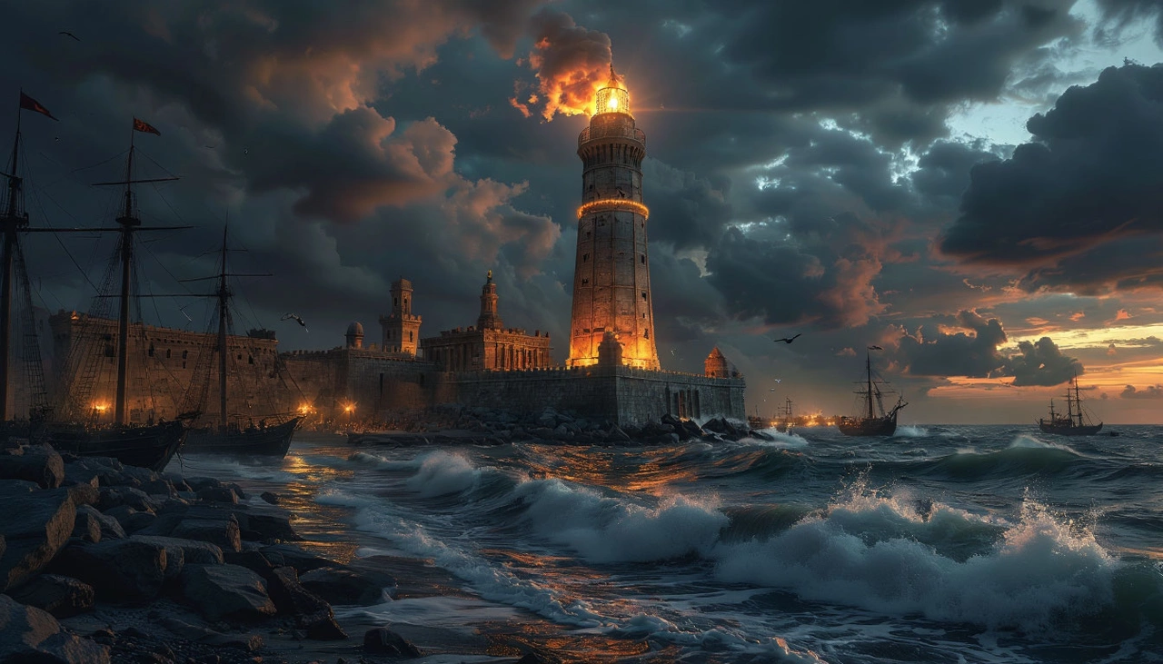
🗼 7th: The Lighthouse of Alexandria – A Tower Lost to the Waves
A beacon of science and safety, the Lighthouse of Pharos once illuminated the Mediterranean under the rule of Ptolemy II. Built in the 3rd century BCE by architect Sostratus of Cnidus, it stood an astonishing 120–150 meters tall — among the tallest structures of its time.
During the day, polished bronze mirrors reflected sunlight across the sea; at night, flames lit up the coast for miles. This marvel guided sailors safely to Alexandria’s port for centuries — until earthquakes between the 8th and 10th centuries turned it into rubble. By the 15th century, its remains were repurposed to construct the Qaitbay Citadel, which still guards the coastline.
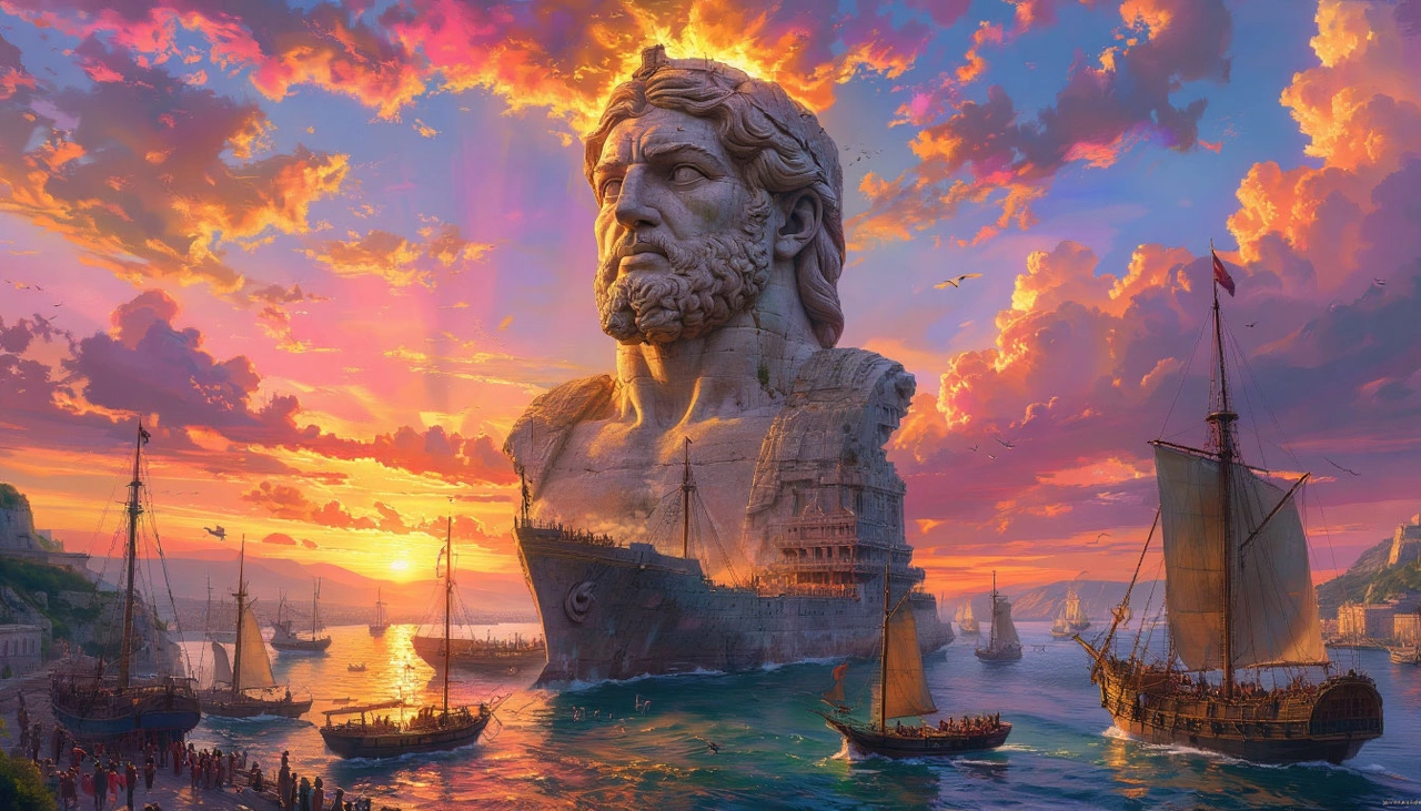
🗿 6th: The Colossus of Rhodes – A Giant That Vanished
Built to celebrate a military victory in 282 BCE, the Colossus of Rhodes stood 30–36 meters tall and symbolized the Sun god Helios. Some legends say it straddled the harbor entrance — ships sailing beneath its massive legs — though modern scholars doubt the feasibility of such engineering.
This grand statue only stood for 56 years before an earthquake shattered it. The ruins remained a tourist attraction for 800 years, until Arab forces allegedly sold the bronze remains as scrap. No trace of it exists today — only stories, speculations, and imagination.
🏛️ 5th: The Mausoleum at Halicarnassus – Royal Grief in Stone
Commissioned by Queen Artemisia II in memory of her husband Mausolus, the Mausoleum of Halicarnassus was more than a tomb — it was a symphony of Greek, Egyptian, and Eastern design. Built in the 4th century BCE, it stood 45 meters tall and featured sculptures by the greatest artists of the time. It withstood earthquakes and invasions for 16 centuries. But in the 15th century, Crusader knights dismantled much of the structure to build the Castle of St. Peter in Bodrum. Fragments remain there today; others reside in the British Museum.
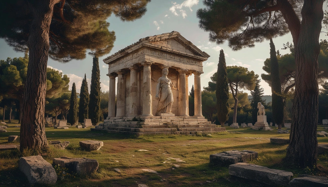
🏹 4th: The Temple of Artemis – Sacred, Beautiful, and Burned
Located in Ephesus (modern Turkey), the Temple of Artemis was considered the most beautiful of the ancient wonders. Built with over 120 marble columns, each 18 meters high, it was both a spiritual and architectural masterpiece. But in 356 BCE, a man named Herostratus set it on fire, seeking eternal fame. Ironically, his name endures — even though the Ephesians banned it. The temple was later rebuilt even more grandly but was eventually destroyed by Gothic raiders in the 3rd century CE. Today, only a single reconstructed column remains.

⚡ 3rd: The Statue of Zeus at Olympia – A God Who Disappeared
Created by the legendary sculptor Phidias in the 5th century BCE, the Statue of Zeus towered inside the Temple at Olympia. The seated god was made of ivory and gold, holding Nike in one hand and a scepter in the other. It stood as high as 17 meters — its head brushing the ceiling. The statue evoked awe, even fear, in those who saw it. But with the decline of pagan worship and the rise of Christianity, the temple was closed. The statue was likely moved to Constantinople, where it was destroyed in a fire — though no one knows for certain.

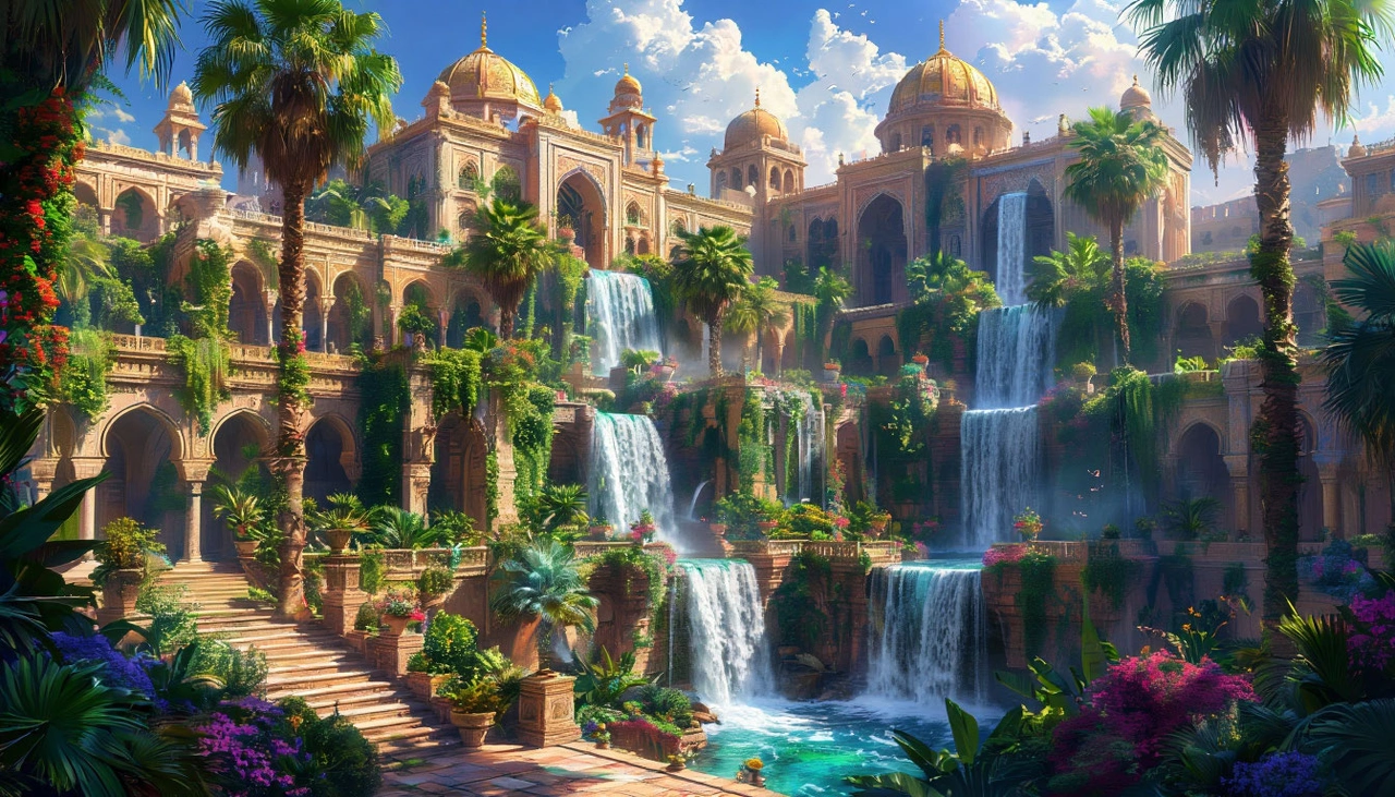
🌿 2nd: The Hanging Gardens of Babylon – The Wonder That Might Not Exist
Unlike the other six wonders, the Hanging Gardens of Babylon are a mystery — and may have been mythical. Said to be built by King Nebuchadnezzar II for his homesick wife around 600 BCE, the gardens supposedly featured lush vegetation on terraced platforms in arid Mesopotamia. No Babylonian records confirm their existence. Greek and Roman authors described them, but inconsistently. Some historians argue they were actually located in Nineveh, not Babylon. Archaeological digs in Iraq have found nothing conclusive.
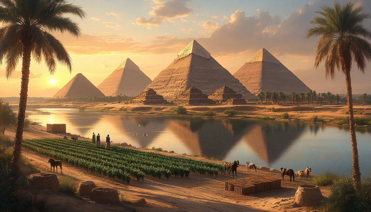
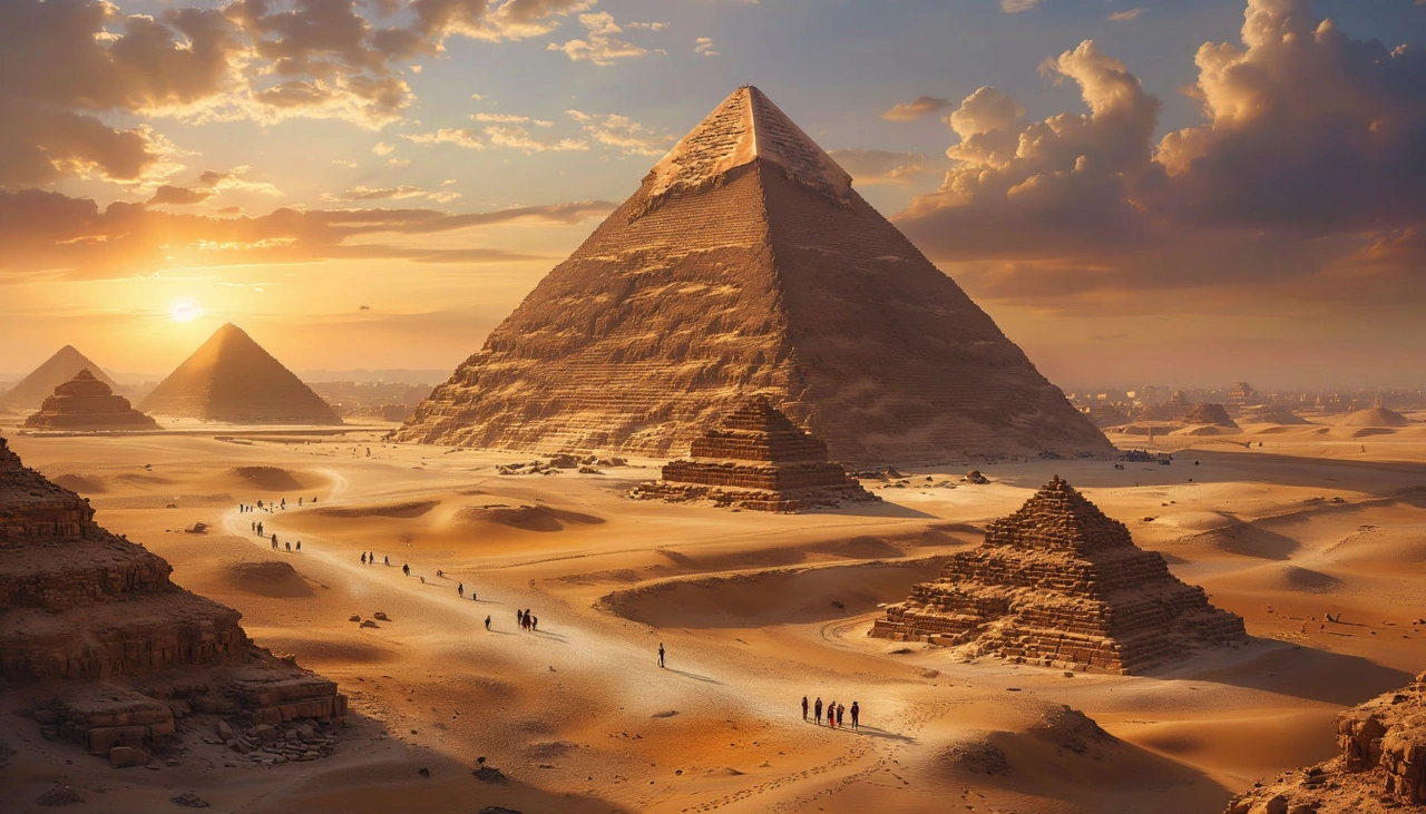
🏜️ 1st: The Great Pyramid of Giza – The Only Survivor
Built around 2560 BCE as a tomb for Pharaoh Khufu, the Great Pyramid of Giza is the only wonder that remains intact. Originally 146.6 meters tall (now 137 meters), it was the tallest man-made structure on Earth for over 3,800 years. Made from over two million limestone blocks, it defies modern understanding of ancient engineering. Some theorize it was built by slaves, others by well-paid seasonal workers. Regardless, it stands as a monument to the coordination, knowledge, and ambition of ancient Egypt.
📚 Why Only One Remains
The wonders of the ancient world were not just tourist attractions. They were spiritual anchors, imperial boasts, and artistic triumphs. Yet all, except one, crumbled. Earthquakes, invasions, religious shifts, and time erased them from view — leaving behind ruins, reconstructions, and questions. Only the Pyramid of Khufu endured. It didn’t just survive. It transcended.
So next time someone asks, "Which of the Seven Wonders of the Ancient World still exists?", you can answer with certainty:
"The Great Pyramid of Giza. All the rest — lost to time."